
The Image Overlay feature allows administrators to upload custom images and overlay them on the Live Tracking map. By defining the image boundaries using latitude and longitude coordinates and adjusting the opacity, the uploaded image is accurately aligned with the geographical location on the map. This enables users to visualize vehicles and assets within custom environments such as factory layouts, mining sites, warehouses, ports, campuses, or construction sites.
To Get Started
- Log in to your account
- Go to setting > master > Image Overlay
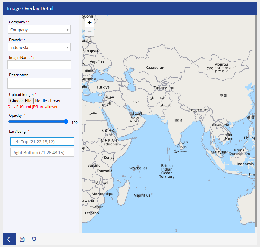
To Create an Image Overlay
- Select the Company from dropdown.
- Select the Branch from dropdown
- Enter an Image Name.
- Enter a Description(optional)
- Click Choose File and upload the image.
- Adjust the Opacity using the slider.
- Specify the Lat/Long coordinates:
- Left Top
- Right Bottom
- Verify the image placement using the Map Preview.
- Click Save to create the image overlay.
Note: The uploaded image is stretched and positioned between the specified coordinates. Ensure the latitude and longitude values accurately represent the image boundaries for proper alignment.